

Spring will reach a fever pitch Sunday and Monday, with plenty of inland 70s and mild air at the coast.
A few showers will fall Sunday night. Wednesday and Thursday will be stormy.
The strong low-pressure system that has been with us since Thursday will exit the region Sunday. This will allow for more sunshine than we had Saturday and less wind, too, as the air-pressure gradient weakens. Expect gusts in the 20s, as opposed to the 30s and 40s we had Saturday.
The sun and lighter winds will allow the strong April sun to work the ground and heat us up. The morning will start in the 40s just about everywhere. Daytime highs will soar into the low and mid-70s inland. The shore will get the typical sea breeze for this time of the year. However, highs in the mid-60s for Longport and the shore will be mild, too.

The sea breeze front can either bring pleasant relief to the summer heat near the shore. Or, it can put you in jackets while those inland stay in shorts.
Clouds will thicken Sunday night. A warm front will lift north throughout the night. As it does so, showers will fall between 9 p.m. and 3 a.m. Don’t be surprised if you hear a rumble of thunder in the night, too.
People are also reading…
They’ll be hit-or-miss showers, so some of you will be dry. If you do rain, up to a quarter-inch will be expected. Winds will come out of the west for the rest of the night. Low temperatures will be in the 50s, which is well above average for this time of the year.
With such a warm start to the day, Monday will feel like spring has reached a fever pitch. Expect 70s for highs everywhere inland. The further away from the chilly ocean and bays, the closer to 80 you’ll be, like in Folsom.
At the shore, temperatures will be comfortably cooler. We’ll be in the 60s for most of the day. Winds will flip and come offshore by late morning.
Sunshine will be around everywhere.
A cold front will sag through the region Monday night. No rain will fall, but winds will come out of the northeast. That will drop overnight lows to between 45 and 50 degrees, cooler than the previous night.
Tuesday will be more seasonable. Highs will be in the upper 50s at the beaches, facing that chilly ocean wind. The further inland you go, the warmer it will get. I’d say mid- to upper 60s will be a good bet.
The stormy part of the forecast is Wednesday and Thursday.
I feel pretty comfortable saying neither day will be a washout. The wettest time should be Wednesday night, with just a few hours of rain during the day Wednesday and Thursday. On Monday, I’ll get into the details on what time rain will begin and end. As long as you can handle the wet ground, many outdoor plans will be OK.
Winds will be breezy to windy both days, too. Enjoy the lull in the tidal flooding now because it should come back both days. Winds will have an onshore component to it.
Temperatures will be mild in the morning and seasonable during the day. Think 50s and 60s most of the time.
An early look at next weekend shows dry weather. High pressure should be large and in charge. Highs should be seasonable — think 60s.

Editor's note: This story was originally posted on May 13, 2019.
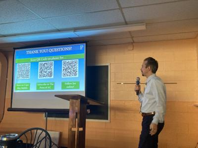
Lastly, a big thanks to the Tabernacle United Methodist Church in Erma for having me come Saturday morning to talk about the Cape May Bubble! I love talk about the bubble after we released our article and video on it in 2019.

Meteorologist Joe Martucci speaks at the Tabernacle United Methodist Church in Erma on Saturday morning about the Cape May Bubble (April 13, 2024).
It was a lively group with lots of question and answers at the end. It was a great time.


Welcome to the discussion.
Keep it Clean. Please avoid obscene, vulgar, lewd, racist or sexually-oriented language.
PLEASE TURN OFF YOUR CAPS LOCK.
Don't Threaten. Threats of harming another person will not be tolerated.
Be Truthful. Don't knowingly lie about anyone or anything.
Be Nice. No racism, sexism or any sort of -ism that is degrading to another person.
Be Proactive. Use the 'Report' link on each comment to let us know of abusive posts.
Share with Us. We'd love to hear eyewitness accounts, the history behind an article.